
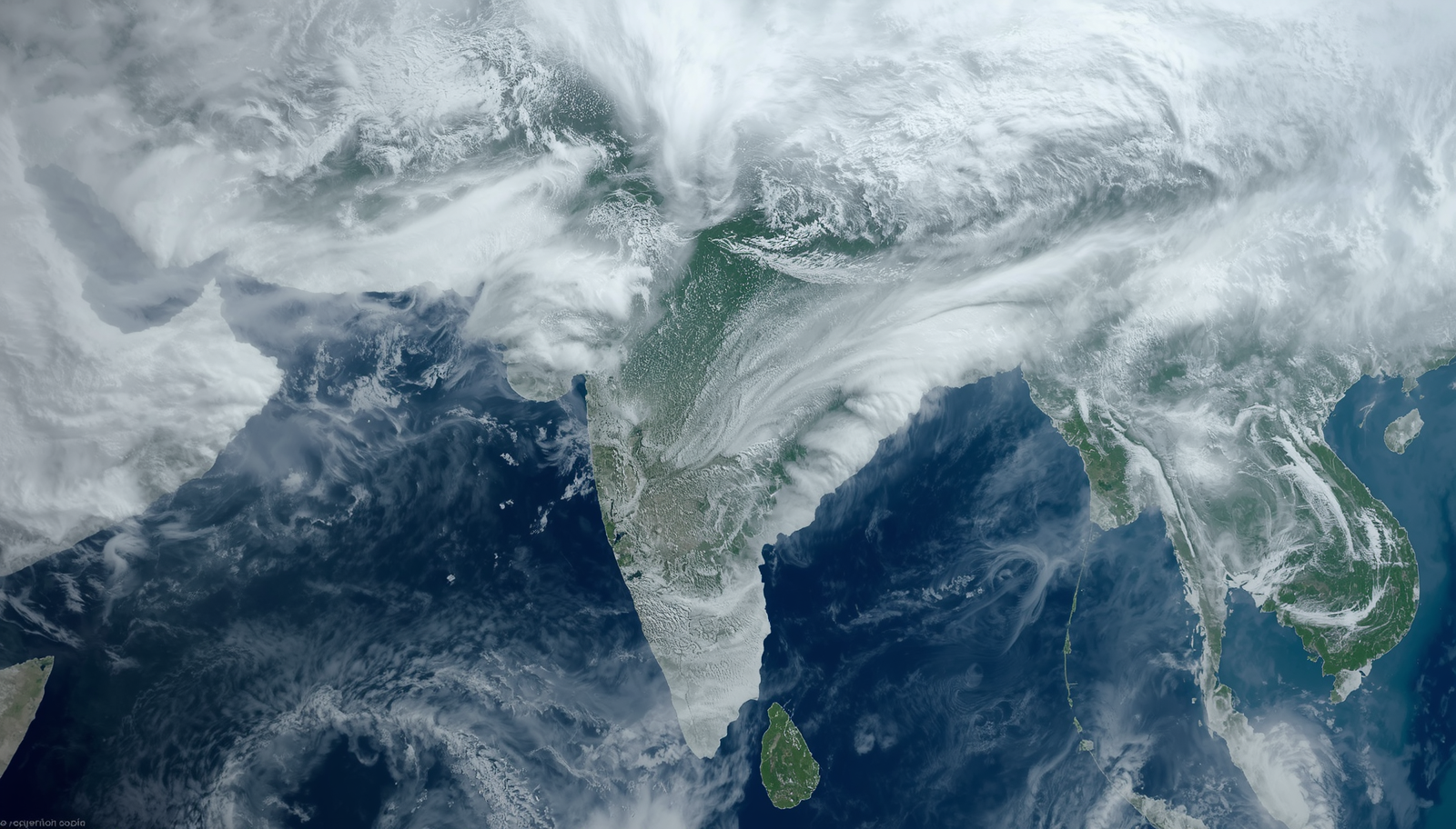

The Indian Space Research Organisation (ISRO) has released high-resolution satellite imagery today, July 22, 2026, showing that monsoon clouds have effectively "swallowed" 95% of the Indian landmass. This represents a significant escalation in atmospheric activity within a mere 48-hour window, as the country braces for what meteorologists suggest will be a period of intense and widespread rainfall.
From Two-Thirds to Near-Total Coverage
The progression of this week's monsoon has been marked by rapid volatility. On July 19, nearly two-thirds of the country was under cloud cover. This was followed by a brief period of uncertainty on July 20, where some satellite captures suggested a potential disappearance of rain clouds over large portions of the territory.
However, by July 21, data from ISRO confirmed a massive surge, with 70% of India covered by intense storm clouds. These clouds were not merely horizontal expansions but exhibited significant vertical growth. As of this morning, July 22, that coverage has expanded to 95%, leaving almost no region of the subcontinent untouched by the current weather system.
Meteorological Characteristics: "Colder, Taller, Deeper"
The satellite data provides more than just a measure of area; it offers a glimpse into the structural intensity of the current formations. ISRO’s sensors have identified these clouds as being "colder, taller, and deeper" than standard seasonal formations.
The "towering" nature of these storm clouds suggests extremely high moisture content and strong convective activity. When clouds reach these heights and maintain such low temperatures at their peaks, it typically correlates with high-intensity precipitation events. This data-driven visualization serves as a precursor to the heavy rainfall expected to hit almost the entirety of India in the coming days.
Confronting the "Godzilla El Niño"
The 2026 monsoon season is being watched with particular scrutiny due to the presence of what has been termed a "Godzilla El Niño" event. Historically, El Niño patterns are associated with suppressed rainfall in the Indian subcontinent. However, the current satellite imagery presents a counter-intuitive visual that challenges simple seasonal predictions.
The fact that 95% of the country is currently under heavy cloud cover suggests a complex interaction between the El Niño effect and local moisture dynamics. While the long-term impact of this El Niño on the season's total volume remains a subject of analysis, the immediate satellite evidence points to an aggressive and widespread monsoon return that defies the usual dry-spell expectations associated with the phenomenon.