
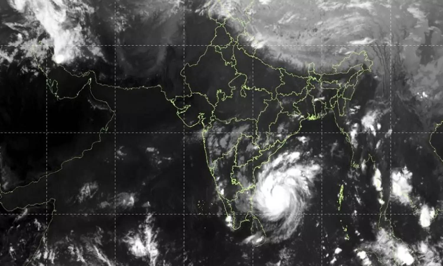

As the northeast monsoon season peaks, the Bay of Bengal has once again become a crucible for severe weather. A deep depression hovering over the central and adjoining south-central regions intensified into Cyclone Muraso on Sunday. Weather monitoring agencies indicate that the system is tracking northwestwards and is poised to make landfall along the Odisha-Andhra Pradesh coast by Monday.
The rapid intensification of the storm has triggered immediate administrative responses, bringing coastal districts of Odisha and northern Andhra Pradesh onto high alert. With memories of previous seasonal destructions still fresh, disaster management frameworks have been activated at a war footing.
Administrative Preparedness in Odisha
Historically, Odisha has emerged as a global benchmark in cyclone disaster management, boasting a zero-casualty policy during extreme weather events. Following urgent weather bulletins on this Sunday morning, the state government has mobilized multiple units of the Odisha Disaster Rapid Action Force (ODRAF) and the National Disaster Response Force (NDRF) to vulnerable southern coastal districts, including Ganjam, Gajapati, and Puri.
District collectors have been directed to identify low-lying areas and initiate pre-emptive evacuations. Relief camps are being stocked with emergency rations, drinking water, and medical supplies. Power and communication utilities have also deployed contingency teams to ensure rapid restoration of infrastructure in the aftermath of the impact.
Meteorological Projections and Vulnerabilities
According to data released by the India Meteorological Department (IMD) on sunday, Cyclone Muraso is packing gale-wind speeds reaching up to high-intensity thresholds near its center.
- Wind Speeds: Destructive winds ranging from 70 to 90 km/h, gusting up to 100 km/h, are expected along the immediate coastline during landfall.
- Precipitation: Extremely heavy to torrential rainfall (exceeding 20 cm in isolated pockets) is forecast for southern Odisha and coastal Andhra Pradesh.
- Storm Surge: Low-lying coastal belts face the risk of inundation due to an expected storm surge.
Agrarian sectors in the path of the storm express grave concern, as the untimely heavy downpour threatens standing paddy crops ready for harvest. Fishermen have been completely barred from venturing into the sea, and all major ports along the coastline have hoisted local danger signals.
Navigating the Next 48 Hours
The coming forty-eight hours will test the resilience of regional infrastructure and the efficacy of Odisha's preemptive protocols. While advanced meteorological modeling ensures that authorities have ample lead time compared to decades past, the sheer volume of anticipated rainfall poses severe urban flooding risks in municipal centers and rural isolation in interior pockets.
As Cyclone Muraso barrels toward the coast, public cooperation remains the linchpin of disaster mitigation. Citizens in vulnerable zones are urged to heed official advisories, stay tuned to verified updates, and relocate to designated shelters before weather conditions deteriorate further on Monday.